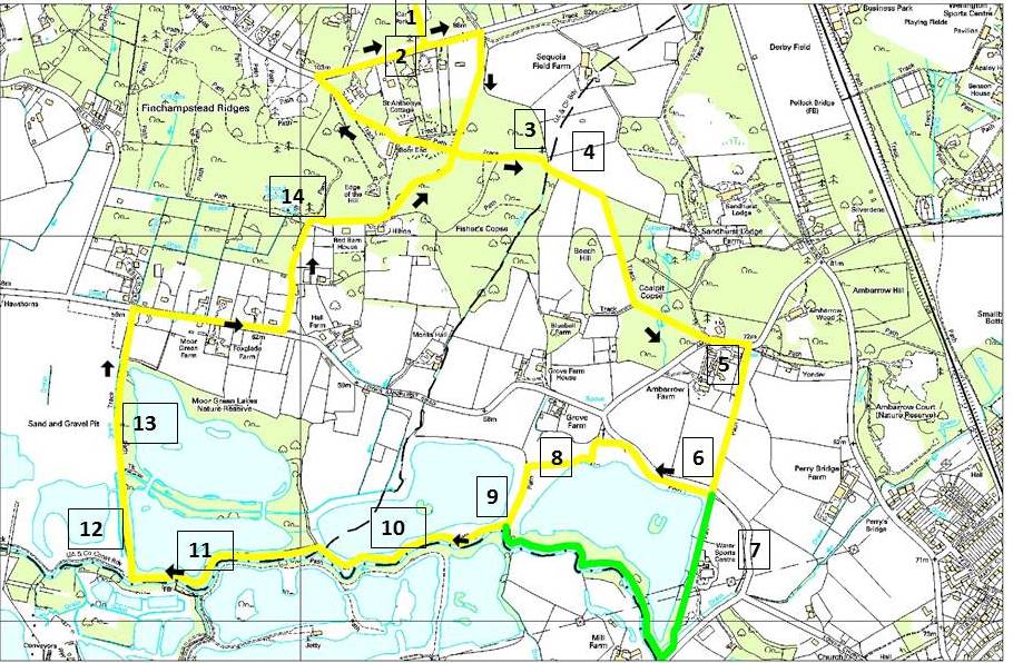
You can download the map here and the directions here
Details of the features of interest at the numbered points can be found here and images can be seen below.
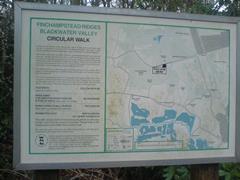
- Simons Wood. Owned by the National Trust this is an area of mixed woodland and heath, which is crossed by several “Rides” including the Devil’s Highway, a Roman Road between Silchester and London. Before leaving the car park it is worth studying the information panel which describes the Wood and adjacent Finchampstead Ridges. At the entrance to the Car Park is a map illustrating this walk, produced by the now defunct Berkshire County Council.
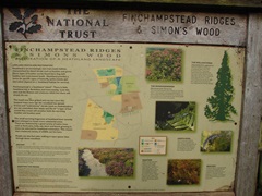
1 Simons Wood panel
1 BCC sign
- Wellingtonia Avenue. Finchampstead Ridges (also owned by the National Trust since 1913) at the northern end of the Avenue formed part of the Bear Wood estate of John Walter, a Berkshire MP and proprietor of the Times newspaper who was responsible for building the road in 1863. Six years later he planted this avenue of Wellingtonia trees. Some sources suggest that it was to commemorate the battle of Waterloo (1815) but it may also be significant that Wellington College, situated at the Southern end in Crowthorne, was opened just ten years earlier by Queen Victoria. These trees are around 150 feet tall and are a type of Sequoia, native to the Pacific Northwest of the USA, first brought to Britain in 1853.
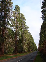
2 Wellingtonia Avenue
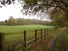
- The footpath through the woods is attractive, especially in autumn, but needs to be followed carefully as there are a number of lesser tracks and at one point a deep ditch seems to form part of the right of way.
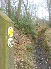
3 Waymarker
3 woods
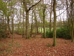
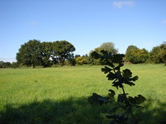
- As you cross into Sandhurst there are initially open meadows on either side and the small copse on Beech Hill soon becomes visible to the right.
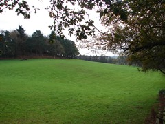
4 Beech Hill
4 FP20 Paddocks
- As you cross the fields down into the Blackwater Valley the old stiles have now been replaced by two kissing gates donated by the East Berkshire Ramblers. There are often large flocks of geese to be seen grazing on the fields to the right and if you look into the middle distance on the left you can just make out the steeple of St Michael’s Church, Sandhurst.
5 finger sign
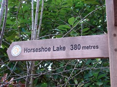
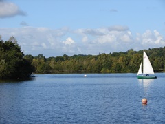
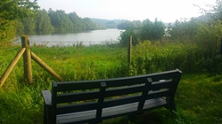
- Horseshoe Lake. The Lake is named after the horseshoe-shaped island in the middle and provides facilities for many forms of water sports which are well used by schools and other groups. It is still also a haven for wildlife including many types of dragonflies and butterflies. Its banks are often grazed in winter by Belted Galloway cattle.
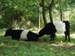
6 Belted galloways
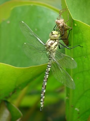
6 Dragonfly
- The Activity Centre offers lessons in sailing and canoeing and also has a café which is open in the summer.
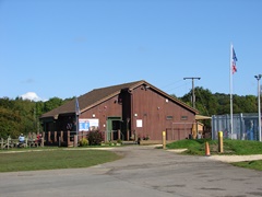
7 Activity Centre
7 boat
- The hedgerows are full of blackberries in late summer and Roe Deer and geese can often be seen in the fields on the right.
8 Hedgerows
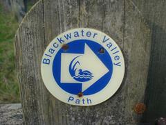
- Blackwater River. The river here forms the boundary between Hampshire and Berkshire. The Blackwater Valley Path runs for 23 miles from the source at Rowhill Copse to Swallowfield where the river meets the Whitewater and the Loddon.
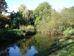
9 Blackwater
9 Blackwater marker
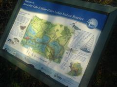
- Moor Green Lakes Nature Reserve. The 90 acre site was previously used for gravel extraction but has now been restored to form the premier location in the Blackwater Valley for observing bird life. In winter a wide variety of wildfowl are seen here including Widgeon, Teal and Goosander. Year round residents include Canada Geese, Cormorants and Coots (the emblem of the Blackwater Valley).
10 Moor Green Lakes
- The information panel by the bridge to Yateley describes some of the fauna found around the Lakes.
11 Yateley panel
- Manor Farm Site. This area and the adjacent Fleet Hill site (across Longwater Road) are still currently (2015) in use for gravel extraction although some restoration is already in progress such as planting reedbeds and removing the large earth mounds around the perimeter, originally designed to minimise noise from machinery.
12 Manor Farm
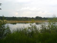
- Moor Green Lakes. The path along the western end of the Lakes offers good views over Colebrook Lake with its islands and Tern rafts. Close to the footpath are bird feeders which attract many tits and finches in winter, and nest boxes in the trees which have helped to rear many chicks such as Barn Owls in 2015 (Photograph: Stuart Croft).
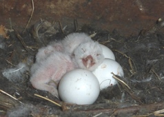
13 Barn owl eggs and chicks
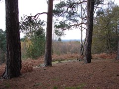
- Finchampstead Ridges. Owned by the National Trust since 1913, this wooded ridge is covered in Birch and Chestnut whilst the upper reaches have extensive Heather and Gorse typical of the ancient heathland. Spout Pond is located only 50 yards from the lower entrance to the Ridges on Drift Lane. From the top there are excellent views cross the Blackwater Valley into Hampshire.
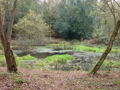
14 Spout Pond
14 Finchampstead Ridges